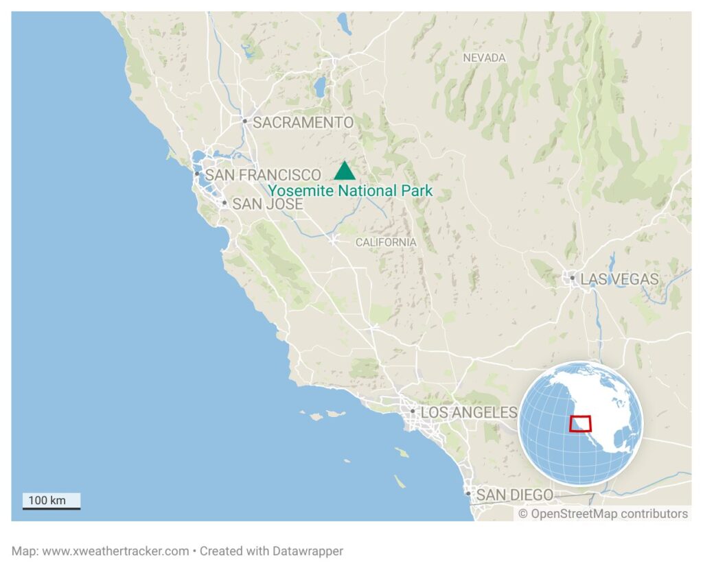
An unsual monsoonal surge has brought intense rainfall to parts of the western United States with Yosemite National Park experiencing 7.5 inches of rain in less than 48 hours.
The extraordinary level of rainfall falling on the Yosemite National Park area over a 48 hour period on 24 and 25 August was 17 times the typical monthly rainfall of 0.44 inches (11 mm). The heavy rain caused flash flooding in parts of Yosemite, with weather alerts including a flood watch, severe thunderstorm warnings, and flood advisories issued by the National Weather Service (NWS). Specific areas impacted included Yosemite Valley, San Joaquin River Canyon, and locations like Clover Meadow Wilderness Office and Merced Lake High Sierra Camp, with some thunderstorms producing large hail and torrential rainfall at rates up to an inch per hour.
Location of Yosemite National Park
This is insane.
— Colin McCarthy (@US_Stormwatch) August 25, 2025
The monsoonal blast hitting California has dumped up to 7.5 inches of rain in Yosemite in less than 48 hours, with back-to-back days of Flash Flood Warnings.
An incredible burst of mid-summer rain for the Sierra Nevada. pic.twitter.com/fpM1m6Q9Wd
The cause of the extreme weather was a late monsoonal pattern, driven by the region’s heat pulling moisture north, creating significant instability. Forecasters warned of a “monsoonal surge” bringing thunderstorms with gusty winds, lightning, and intense heavy rain. This is exactly what played out in California’s interior mountains and eastern deserts.
A number of areas remained under flood watch in to 26 August due to the ongoing threat of heavy storms including Yosemite Valley, Sequoia and Kings Canyon National Parks, Mammoth Lakes, and much of the Sierra foothills. The Tahoe basin faced a flash flood watch, with the NWS warning of “excessive rainfall” that could trigger flooding or debris flows, particularly in areas with burn scars.
Lightning strikes posed an additional threat from the southern California interior through to the northern Sierras. The U.S. Forest Service recorded over 10,000 lightning strikes within a 24-hour period through 23 and 24 August with only one new significant fire being reported, the Garnet fire in the Sierra National Forest. Believed to be triggered by lightning, the fire started on 24 August south of Rodgers Ridge near Garnet Dike and spred rapidly covering an area of 9,159 acres (3850 ha) by 26 August. with a reported 0% containment.
The Garnet Fire continued to burn overnight, growing to roughly 8,500 acres, the U.S. Forest Service reported Tuesday morning.https://t.co/MV0BuM2PtE
— Anthony W. Haddad (@TonyTriesNews) August 26, 2025
The steep, rocky terrain, has complicated firefighting efforts as bulldozers cannot be used in many areas. High temperatures and strong winds from thunderstorms have further fueled the fire’s spread, particularly northward toward Patterson Buttes. Firefighters are focusing on protecting infrastructure, including hydroelectric resources. Over 150 firefighters are involved, supported by four fixed-wing planes and helicopters. A Complex Incident Management Team assumed command on 25 August to coordinate the response.