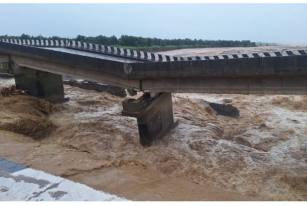
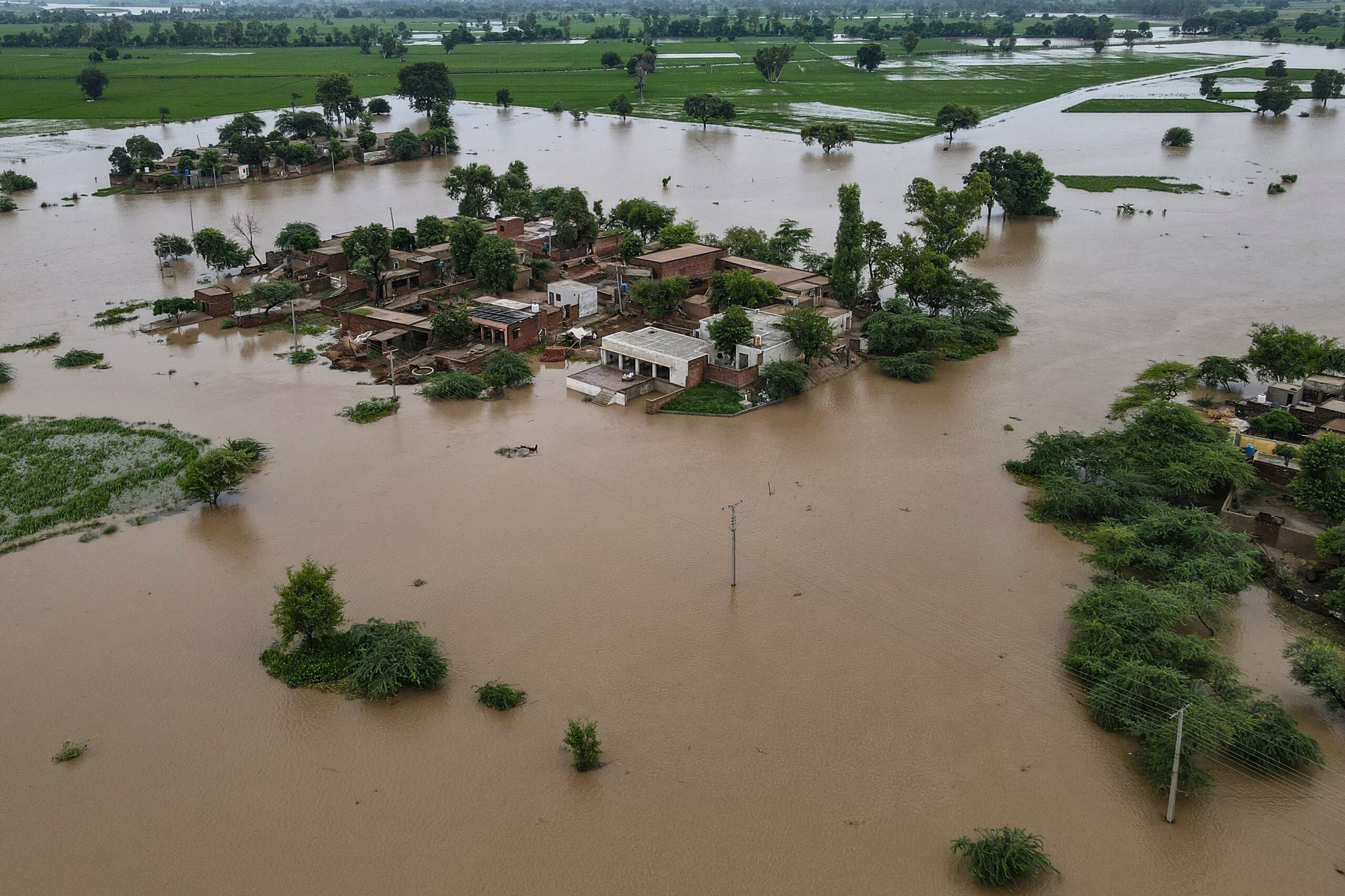
State of the UK Climate 2024 – Infographic
Below is a summary of the key findings of the ‘State of the UK’s climate in 2024’ a report published…
The warmer temperatures that were forecast for Scandinavia late last week very much came to fruition on 14 July, with…
The Copernicus Climate Change Service latest climate bulletin highlights that June 2025 was the warmest June on record for western…
A pivotal study by University College London and the London School of Hygiene & Tropical Medicine, published in PLoS Climate, predicts a sharp increase in heat-related deaths in England and Wales due to climate change.
The heat wave that struck France in June and early July 2025 was one of the most intense and prolonged early summer heat events in recent history, driven by a persistent “heat dome” that resulted in high anomalous temperatures across much of the country.
At the time of writing, the death toll from the flash floods that struck central Texas on 4 July has passed 100 and is expected to rise further as search efforts continue with over 20 people still missing.
The catastrophic flooding in Central Texas on 4-5 July 2025, resulted from a combination of meteorological factors that converged to produce an extreme rainfall event
The heat wave engulfing the Iberian peninsula and France produced two record June temperatures as the month came to a close in Spain and Portugal.
In the last week significant flood events have occurred simultaneously in southern China. A vast rainstorm belt swept across southern China from 17-24 June, bringing record-breaking rainfall. Northern Liuzhou, Guangxi, recorded over 1 000 mm in a five day period, prompting significant flood alerts and evacuations of tens of thousands of people.
From 21-24 June, a powerful heat dome, a high-pressure system trapping hot air drove record-breaking temperatures across the central and eastern United States, with relentless heat building daily and offering little respite.
Hurricane Erick made landfall on Mexico’s Pacific coast, specifically in western Oaxaca near Punta Maldonado, around 06.00 local time on Thursday 19 June as a Category 3 major hurricane with maximum sustained winds of approximately 125 mph (205 km/h).
A new study from the UK Met Office published in Weather Journal has indicated that temperatures exceeding 40°C in the summer months will become increasingly likely within the next decade due to escalating climate trends.
Researchers from Nasa have analysed new data which indicates a significant rise in the intensity of weather events such as droughts and floods over the past five years.
It has been reported that a temperature of 52.6°C on Failaka Island,Kuwait was recorded on 15 June. Nearby Bubyan Island recorded 51.3°C, and other regional temperatures exceeded 50°C.
On 12 June, San Antonio, Texas, experienced severe flash flooding triggered by a slow-moving thunderstorm system exhibiting “training,” where storms repeatedly passed over the same area.